This blog is by J.B. Elliott and me, and is a response to a request: I think it would be interesting to the blog group if you could describe a classic snow event set up for our area. It would be great to learn what dynamics it takes to have a snow in Bham. You guys are the best. Tom Hontzas, John’s Famous Slaw Dressing
The Gulf of Mexico is important in almost all of Alabama’s significant snow events. The most ideal sequence of events for us to get a “substantial” snow is for a surface low pressure area to form in the Gulf and move toward the northeast. Those lows can spread moisture inland, and since lows usually form along fronts, the cold air is already in place. These lows are also often accompanied by strong upper-level disturbances.
Precipitation forms when moist air rises. Air rises either due to an approaching upper-level disturbance, or due to warm air moving in. Cold air moving in tends to cause air to sink, which is why often the rain ends before the coldest air arrives, or the cold air moves out as the rain moves in (like this weekend, the rain was partially caused by warm air moving in). But, with a Gulf low, the cold air is already here and doesn’t have to move in, so the air rises easily. If the air is cold enough in all the right places, especially at the height where the moisture turns into cloud and precipitation drops, the snow can come fast and furious.
The exact track of the low is also important. Some of the heaviest
snow will be in about a 50-mile wide band on the north side of the
low, usually near the track of the upper-level disturbance. If the low tracks too far south, Birmingham can also miss out completely. In the mid 1970s, Auburn got about 14 inches and Birmingham none. If the low tracks too far north, either the heaviest snow will be in Huntsville or Nashville, or warm air will come in and Birmingham will get rain.
There are cases when snow falls without a Gulf low, and even as cold air moves in, if a strong upper-level disturbance moves through. Today was a good example. The upper-level disturbance was strong enough to overcome the suppressing effect of cold air moving in, so we got some light snow. Occasionally, events like this can cause a snow accumulation. But, they usually just cause flurries or a dusting.
Snow cover is also very efficient at reflecting sunlight during the day and radiating heat at night, so very cold temperatures often occur after a snowfall. When Alabama’s all time low temperature of 27 below zero occurred at New Market (north of Huntsville) on January 30, 1966 there was 12 inches on the ground. Birmingham reached 2 degrees on the morning after the snow had stopped in the Blizzard of 1993.
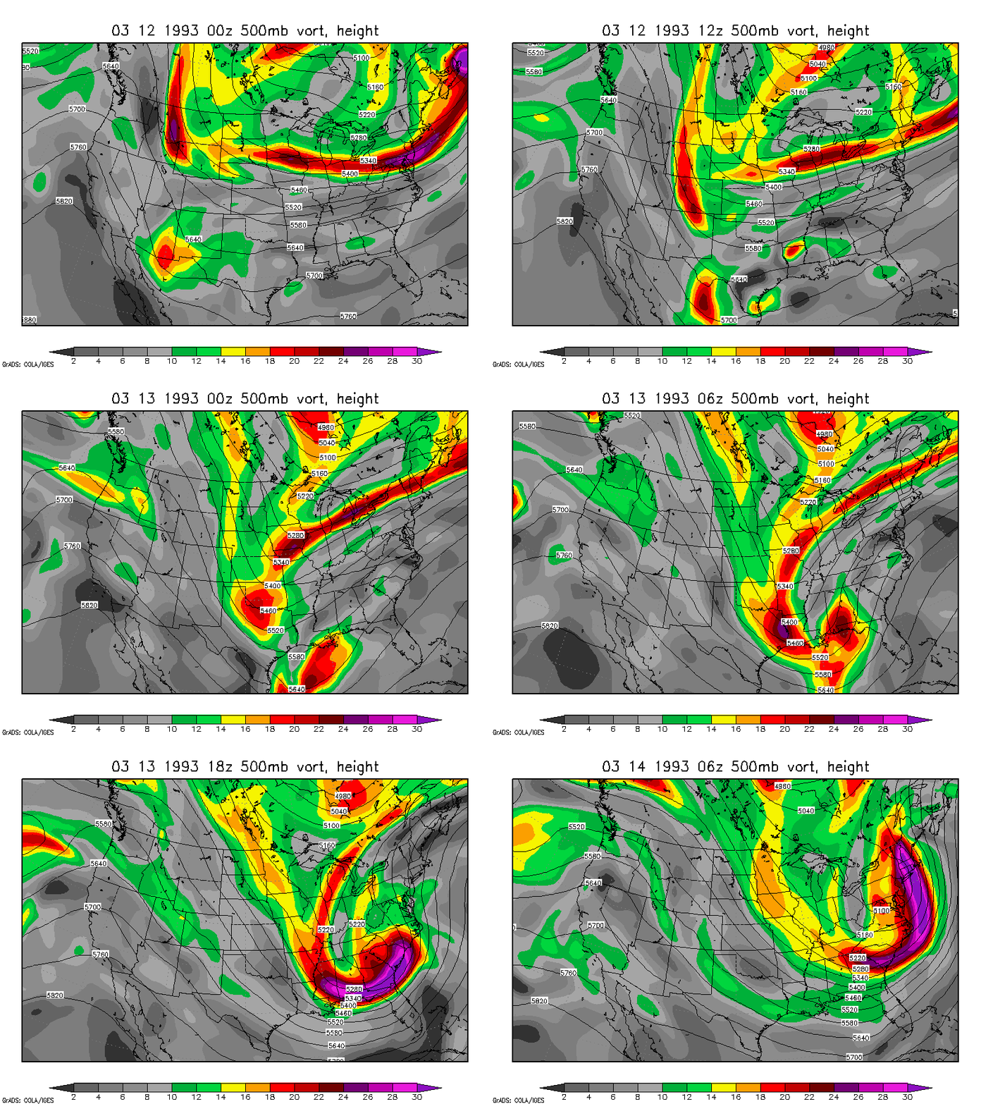
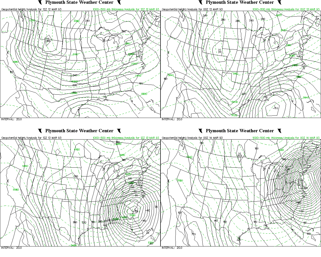
The Blizzard of 1993 is a classic case of the perfect snow setup in Birmingham. Two upper-level disturbances approached a stalled front near the Gulf coast, forming a surface low pressure area in the NW Gulf. The low pulled cold air southward on its west side, intensifying the upper-level trough, and a positive feedback started. The convergence into the low pressure and the divergence aloft caused rapidly rising air and very heavy snowfall. The large gradient between higher pressure to the NW and the low in the Gulf caused high winds. Up to 20 inches of snow fell over northeast Alabama. Up to 17 inches fell in the Birmingham area, but officially 13 inches at the airport. Thunder and lightning also occurred during the heaviest snow.
Here are maps of the upper-level flow and disturbances in the Blizzard of 1993, and the surface flow also. Click on the maps to view movies.